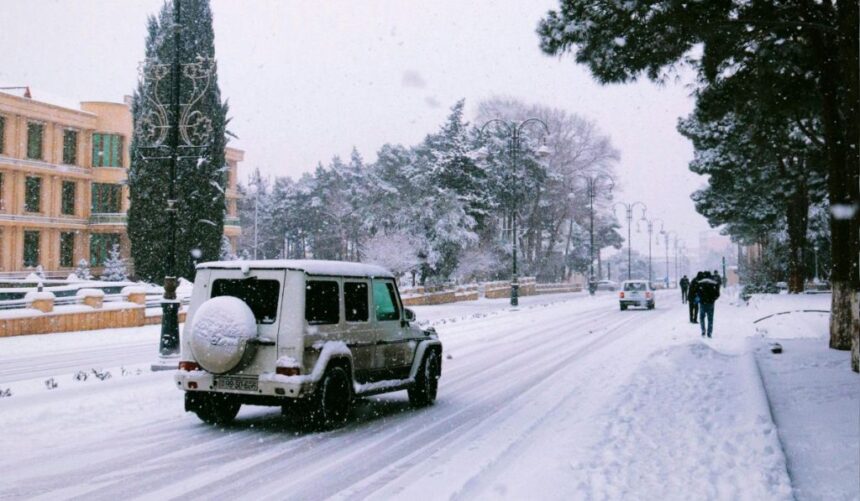
The latest winter storm and accompanying surge of Arctic air have produced significant weather impacts across multiple U.S. regions, affecting travel, public safety, and transportation networks.
Within the past several hours, updated meteorological assessments indicate that the Northeast, Upper Midwest, Ohio Valley, and Pacific Northwest remain under the most active alerts.
Officials across these states continue urging residents to limit travel, highlighting risks from heavy snow, ice, flooding, and dangerous wind chills.
Forecasters note that the storm intensified as it moved eastward, dropping accumulating snow across major metro corridors before deep cold settled over the Midwest. At the same time, a separate but related Pacific system enhanced rainfall and flooding in the Northwest. As one regional emergency manager stated, “We are asking residents to remain off the roads unless travel is absolutely essential, as conditions are changing faster than crews can respond.”
Below is a structured, region-by-region overview of the states currently affected, summarizing primary hazards and ongoing travel concerns.
Northeast and Mid-Atlantic
| Primary Impacts | Travel Concerns | Notes | |
|---|---|---|---|
| NY | Heavy snow, icy roads, cold wind chills | Airport delays, hazardous driving in metro areas | First major snowfall of season |
| NJ | Significant snow accumulation | Reduced visibility, slow-moving traffic | Road crews prioritizing primary routes |
| PA | Snow and flash-freeze potential | Treacherous interstates, advisory-level travel | Statewide winter alerts active |
| CT | 2–5 inches snow, cold blast | Icy secondary roads | Cold-weather protocols activated |
| MA | Light-to-moderate snow, strong winds | Spotty road icing | Ongoing winter weather advisories |
| RI | Light snow, freezing temps | Localized slick roads | Impact primarily coastal-inland mix |
Upper Midwest and Northern Plains
| Primary Impacts | Travel Concerns | Notes | |
|---|---|---|---|
| MN | Subzero temps, dangerous wind chills | Ice glaze on roads; slow transit | Coldest morning of season |
| ND | Arctic air, drifting snow | Patchy whiteouts | Extreme wind chill warnings |
| WI | Snow remnants, severe cold | Hazardous rural travel | Multiple cold-related advisories |
| IL | Subfreezing temps, icy spots | Commuter delays | Flash-freeze hazards early morning |
| IA | Mixed wintry precip, cold air | Icy bridges, rural road slickness | Overnight temp drops complicate cleanup |
| IN | Snow-to-ice transitions | Numerous crashes reported | Widespread travel difficulties |
Ohio Valley and Central Appalachians
| State | Primary Impacts | Travel Concerns | Notes |
|---|---|---|---|
| OK | Record early-season snowfall | Difficult interstate travel | School and transit adjustments |
| KY | Snow and freezing drizzle | Reduced visibility, slippery roadways | Localized utility disruptions |
| WV | Mountain snow, icy elevations | Dangerous mountain pass conditions | Cold-air damming extends storm effects |
Pacific Northwest ( System)
| State | Primary Impacts | Travel Concerns | Notes |
|---|---|---|---|
| WA | Catastrophic flooding, mudslides | Road closures, detours, evacuation routes active | Emergency declarations in several counties |
| OR | Heavy rain, saturated soils, landslides | Blocked rural highways, unstable slopes | Additional rainfall forecast may worsen impacts |
Summary Outlook
The recent storm continues to influence at least a dozen states, with the most severe hazards concentrated in regions experiencing heavy snow or extreme cold. Travel remains unpredictable due to shifting precipitation bands, freezing temperatures, and ongoing infrastructure stress.
Residents and travelers across affected areas are advised to:
- Monitor local and state transportation updates
- Allow additional travel time or postpone non-essential trips
- Remain alert for rapid visibility changes
- Prepare vehicles for winter conditions
If you want, I can also prepare state-by-state briefing sheets, visual infographics, or a condensed version for broadcast or social media.