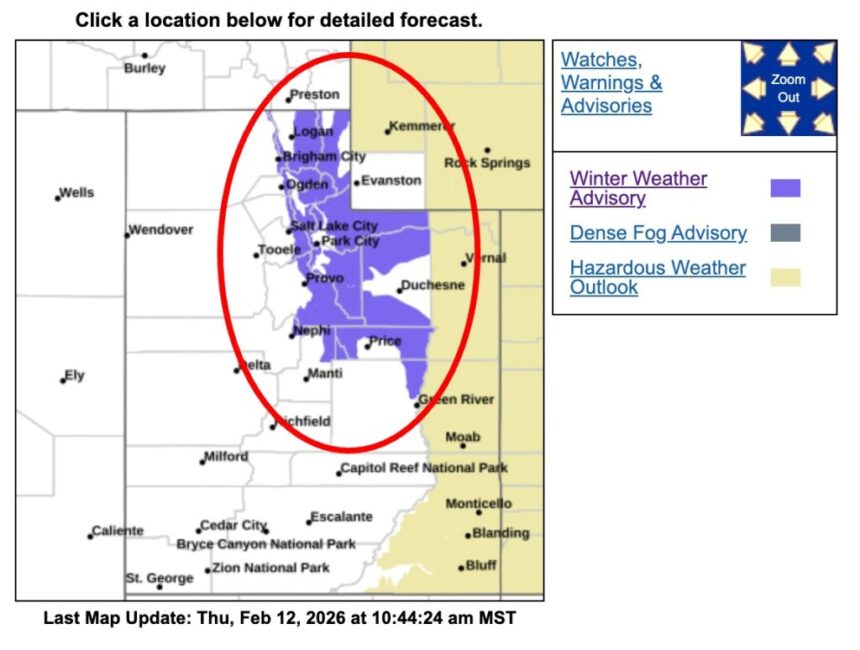
The National Weather Service (NWS) in Salt Lake City has issued an urgent winter weather advisory affecting mountainous regions across 15 Utah counties, warning of renewed snowfall and hazardous travel conditions through Thursday afternoon.
The advisory, issued at 4:53 a.m. MST on February 12, 2026, remains in effect until 5 p.m. MST. Forecasters report that snow showers, which briefly diminished during the late morning hours, are expected to intensify again later in the day.
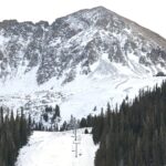
Additional snow accumulations of 2 to 4 inches are forecast for the Wasatch Mountains and the Western Uinta Mountains, while the Wasatch Plateau and Book Cliffs could receive 1 to 3 inches.
Areas specifically mentioned in the advisory include Alta, Brighton, Logan Summit, Mantua, Moon Lake, Mirror Lake Highway, Scofield, and Indian Canyon. Higher elevations are expected to experience the most significant impacts, with brief periods of moderate to heavy snowfall possible during the afternoon.
Meteorologists caution that even relatively modest snow totals can create dangerous road conditions, particularly in mountainous terrain where elevation changes and shaded roadways allow snow and ice to accumulate quickly. Reduced visibility during heavier bursts of snowfall may further complicate travel.
“Winter driving conditions are expected,” the advisory states, urging motorists to slow down and use caution. Slick roads, snow-packed surfaces, and sudden weather changes could lead to delays and an increased risk of accidents, particularly along mountain passes and high-elevation highways.
The Utah Department of Transportation (UDOT) is advising drivers to check real-time road conditions before traveling. Updated traffic and road information is available at udottraffic.utah.gov.
The National Weather Service also provides graphical snowfall forecasts, including official, high-end, and low-end accumulation estimates, on its website at weather.gov/slc/winter.

Winter weather advisories are issued when snow, blowing snow, sleet, or freezing rain is expected to create inconveniences and potentially hazardous conditions. While not as severe as a winter storm warning, advisories signal that caution is necessary, especially for those traveling through affected regions.
Utah’s mountainous areas frequently experience rapidly shifting weather patterns during winter months. Afternoon reinvigoration of snow showers, following a temporary lull, is common when atmospheric moisture and cold air combine with terrain-driven weather systems. Forecasters emphasize that conditions can change quickly in these regions, making preparation essential.
Residents and visitors planning travel through the Wasatch or Uinta ranges are encouraged to allow extra time, reduce speed, and ensure vehicles are equipped for winter conditions. Carrying emergency supplies, including blankets, water, and traction devices, is strongly recommended.
The advisory underscores the importance of monitoring updated forecasts throughout the day, as snowfall intensity and coverage may fluctuate. Additional statements or updates may be issued if conditions worsen.
For more information, residents can visit the National Weather Service Salt Lake City office website at weather.gov/saltlakecity. Travelers are also encouraged to consult UDOT resources for the latest road and traffic updates before departing.
Officials reiterate that caution and preparedness remain the most effective measures to ensure safety during winter weather events.