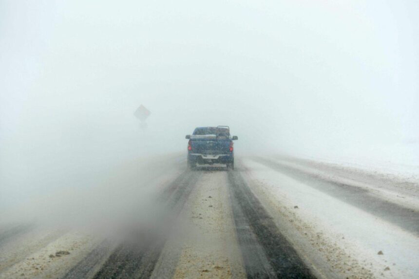
Coloradans heading to the mountains this weekend to enjoy fresh powder should reconsider their plans, with an incoming winter storm likely making travel difficult or impossible on major highways, according to weather officials.
National Weather Service forecasters issued a winter storm warning for most of Colorado’s northern and central mountains from 11 p.m. Friday to 11 p.m. Saturday and “strongly recommended” that people change their travel plans.
“Snow and blowing snow will reduce visibility to a quarter mile or less. Near blizzard conditions are possible, especially Saturday morning. Travel will be very difficult to impossible, with road closures possible,” forecasters wrote in the alert.
The heaviest snowfall through the mountain corridors is expected between midnight Friday and noon Saturday, weather officials said.
Colorado highway snow forecasts:
- Interstate 70: 1-4 inches in Idaho Springs, 5-10 inches in Georgetown, 8-15 inches at Eisenhower Tunnel, 5-10 inches in Silverthorne, 9-15 inches on Vail Pass.
- U.S. 40: 8-13 inches in Steamboat Springs, 20-30 inches on Rabbit Ears Pass, 3-6 inches in Kremmling, 4-8 inches in Granby, 8-14 inches in Winter Park and on Berthoud Pass, 4-9 inches in Empire.
- U.S. 34: 5-10 inches in Grand Lake, 9-17 inches at Alpine Visitors Center in Rocky Mountain National Park (which is closed to through traffic for the season,) 1-4 inches in Estes Park.
- Colorado 14: 3-7 inches in Walden, 4-12 inches in Gould, 9-18 inches on Cameron Pass, 2-4 inches in Rustic.
Colorado Department of Transportation officials also issued a travel alert Friday night, stating drivers should be prepared for icy, snow-packed conditions and road closures.
Anyone who must travel should bring emergency supplies, including an extra flashlight, food and water, NWS officials said.
This is a developing story and will be updated.
Get more Colorado news by signing up for our daily Your Morning Dozen email newsletter.