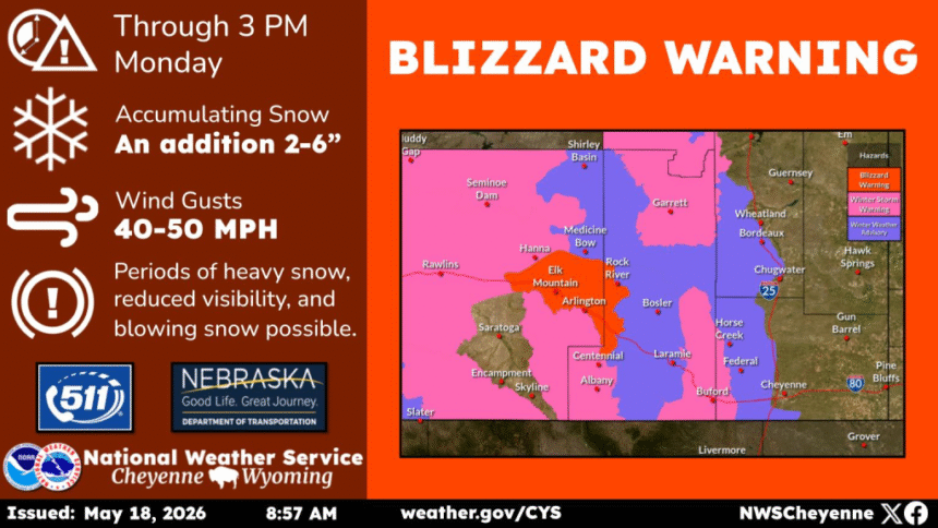
An unseasonable and powerful late-season winter storm is battering Wyoming this Monday morning, with the National Weather Service office in Cheyenne issuing a Blizzard Warning and multiple Winter Storm Warnings across a wide swath of the state as of 8:40 AM MDT, May 18, 2026.
The system has caught motorists and commuters off guard at a time of year when trees across the region have already leafed out — making the heavy, wet snow particularly destructive.
The NWS Cheyenne office stated plainly in its Blizzard Warning bulletin: “Travel should be restricted to emergencies only. If you must travel, have a winter survival kit with you. If you get stranded, stay with your vehicle.”
Blizzard conditions are currently occurring along Interstate 80 in the North Snowy Range Foothills, including the communities of Arlington and Elk Mountain, where wind gusts are reaching 50 mph and visibilities may drop below one quarter of a mile due to falling and blowing snow.
A Multi-Zone Warning Spanning Wyoming’s Mountain Corridors

The storm’s reach is extensive. Across the Snowy Range and North Laramie Range — including Centennial and Albany — the NWS is forecasting 10 to 20 inches of total snow accumulation, with gusts of 30 to 40 mph and significant blowing and drifting above 8,500 feet. The South Laramie Range, which straddles the critical I-80 summit between Cheyenne and Laramie, is under warning for 7 to 14 inches and gusts to 40 mph.
In Central Carbon County, including Rawlins, 5 to 10 inches are expected with gusts to 45 mph and visibility potentially falling below a quarter mile. The Sierra Madre Range faces 8 to 16 inches concentrated on its eastern slopes, with 50 mph gusts capable of causing tree damage. Casper Mountain is warned for 6 to 12 inches, and the NWS specifically notes that heavy snow could break tree limbs as many trees have already leafed out — an unusual hazard unique to late spring storms. The city of Casper itself is expected to receive 3 to 6 inches, with up to 8 inches possible between Hiland and the south side of the city.
The Storm Extends Into Colorado

The system does not end at the Wyoming border. NWS Denver issued a Winter Storm Warning for Rocky Mountain National Park and the Medicine Bow Range in Colorado, valid until 9 PM MDT, with snow accumulations of 8 to 18 inches expected on east-facing slopes — threatening travel on mountain passes and affecting the Monday evening commute. Road conditions in Colorado and Wyoming can be checked at wyoroad.info or by calling 511.
The event is a vivid reminder of what meteorologists know well: in the central Rocky Mountain corridor, winter does not observe the calendar. May storms of this magnitude, while uncommon in lower elevations, are not without precedent in the high country. What makes today’s system notable is its breadth — simultaneous blizzard and winter storm conditions across six distinct Wyoming mountain zones, all confirmed active on the same Monday morning.