A powerful winter storm continues to sweep across large areas of the United States, bringing heavy snowfall, strong winds, and dangerous travel conditions.
Multiple states have issued weather warnings and emergency advisories as the storm disrupts transportation networks, closes schools and businesses, and strains local infrastructure.
As conditions evolve, photo reports shared on X are providing real-time visual documentation of the storm’s impact. Images from residents, journalists, and emergency responders capture snow-covered streets, immobilized vehicles, and ongoing response efforts, offering a ground-level view of the situation as it unfolds.
LATEST UPDATES FROM X:
Snowstorm Reports from Mississippi
Snowstorm Reports from Illinois
Snowstorm Reports from Kentucky
Snowstorm Reports from Tennessee
Snowstorm Reports from MISSOURI
Snowstorm Reports from OKLAHOMA
Snowstorm Reports from ARKANSAS
Snowstorm Reports from KANSAS
Snowstorm Reports from TEXAS
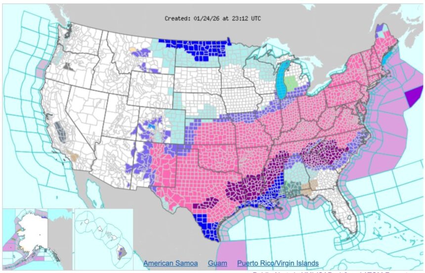
Forecast: Continued Snow, Ice, and Frigid Conditions Expected Across Broad Swaths of the United States
Meteorologists and official forecast guidance indicate that the winter storm — unofficially designated Winter Storm Fern by some weather services — will continue to move eastward through Monday, bringing significant accumulation of snow, sleet, and freezing rain from the Southern Plains into the Northeast and New England. Heavy snow totals — locally exceeding one to two feet in parts of the Ohio Valley, Mid-Atlantic, and New England — remain possible, with widespread winter weather alerts in effect across dozens of states.
Dangerous conditions are expected to persist as the system expands its reach and slows in forward motion, allowing snow and ice to accumulate over an extended period.
In addition to snow and ice, meteorologists are forecasting dangerously cold temperatures and frigid wind chills that could hamper recovery efforts and contribute to prolonged hazards on roads and infrastructure. Freezing rain and ice accumulation continue to present elevated risk for power outages and hazardous travel, particularly in areas less accustomed to severe winter precipitation. Officials urge the public to monitor updates from the National Weather Service and local authorities, maintain awareness of evolving conditions, and adhere to safety guidance as the storm continues to impact broad regions of the country through the weekend and into early next week.